
 SkillClick
How Many GCPs Do You Need for Drone Mapping Accuracy?
Ground Control Points or GCPs are really important for getting results from drone surveys. Whether you are working in construction or agriculture or mining or land surveying the right number of GCPs will make a difference in the quality of your photogrammetry results. A lot of people who are just starting out have trouble figuring out how many GCPs for drone mapping they need to get good mapping results.
In this article we will break down the number of GCPs, where to put them and how they affect the accuracy of your maps.
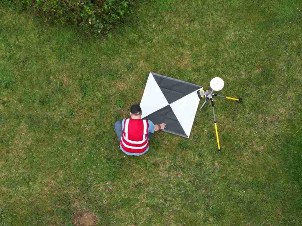
What are GCPs in drone mapping?
GCPs are markers that we put on the ground with known coordinates. We use GPS equipment to measure these points and then use them to make sure our drone pictures are in the right place.
They help fix a things:
-
Horizontal accuracy, which is the X and Y coordinates
-
Vertical accuracy, which is the elevation or Z values
-
Image distortion in photogrammetry models
In terms GCPs are like anchors that tie your drone data to real-world coordinates.
Why GCPs Matter for Accuracy
Really good drones with RTK or PPK systems can make small mistakes due to factors like satellite signals, terrain, and flight limitations. GCPs help reduce these mistakes a lot.
They make a things better:
-
Orthomosaic precision
-
Digital Elevation Model or DEM accuracy
-
3D reconstruction quality
-
Survey-grade deliverables
If you do not have control points your results might look okay at first but they will not be reliable.
How many GCPs do you need?
The number of GCPs you need depends on a things, like how big the area is, how complicated the terrain is and how accurate you need it to be. There is no one-size-fits-all answer. There are some general guidelines.
Here are some general guidelines:
-
For sites like 1 to 5 hectares you need at least 3 to 5 GCPs.
-
For sites like 5 to 50 hectares you should use 5 to 10 GCPs.
-
For sites, like 50 hectares or more you need 10 to 20 or more GCPs depending on the terrain.
The key thing to remember is to make sure your GCPs are spread out across the project area not all in one place.
Best practices for placement are important.
Where you put your GCPs is just as important as how many you use. If you do not spread them out well your results will not be accurate even if you use a lot of GCPs.
Here are some guidelines to follow:
-
Put one GCP near each corner of the survey area.
-
Add some points in the center to make the model more stable.
-
Make sure the GCPs are easy to see from the air like with high-contrast targets.
-
Do not put all the points on uniform terrain.
-
If the site has slopes include some elevation variation.
-
GCPs and RTK drone mapping are related.
GCPs vs RTK Drone Mapping
A lot of drones use RTK or PPK systems, which reduce the need for control points.. These systems do not completely replace GCPs.
Here are the key differences:
-
RTK and PPK drones reduce the number of GCPs you need.
-
They improve accuracy in real-time or after processing.
-
Traditional drone surveys depend heavily on GCPs for georeferencing.
-
They need ground control to ensure accuracy.
A lot of workflows use a combination of both.
Several things affect how many GCPs you need
These include:
-
How complicated the terrain is, like if it is flat or mountainous.
-
How accurate you need the mapping to be, like for engineering or visual mapping.
-
How high the drone is. How much the pictures overlap.
-
What kind of deliverable you are making like an orthomosaic or a 3D model.
-
How good the drones sensor and GPS are.
If the environment is more complicated you usually need control points.
There are some mistakes to avoid
Experienced people sometimes make mistakes with GCPs, which leads to poor results.
Common Mistakes to Avoid
-
Placing GCPs close together.
-
Ignoring the edges of the site.
-
Using GPS readings that are not accurate.
-
Not marking the GCPs clearly in the pictures.
-
Skipping checkpoints to validate the results.
Conclusion
In conclusion, the number of GCPs you need for drone mapping is not set in stone. It follows some practical standards based on the project's size and accuracy requirements. For professional projects, 5 to 10 well-distributed control points are enough for medium-sized areas while larger or more complicated terrains may need more. Using GCPs for drone mapping can improve survey accuracy, enhance data reliability, and ensure professional-grade outputs. Ground Control Points or GCPs are really important for getting results from drone surveys.
- Managerial Effectiveness!
- Future and Predictions
- Motivatinal / Inspiring
- Fitness and Wellness
- Medical & Health
- Manufacturing
- Education
- Real-Estate
- Food Industry
- Hospitality
- Online Games
- Sports
- Home Services
- Civil Engineering
- Safety and Protection
- Software Products & Services
- Fashion and Jewellery
- Artificial Intelligence
- Entrepreneurship
- Mentoring & Guidance
- Marketing
- Networking
- HR & Recruiting
- Literature
- Shopping
- Career Management & Advancement